 vesseltracker.com
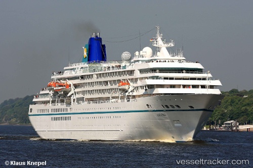
Vessel Amadea IMO: 8913162, MMSI: 308445000 Cruise Ship
UTC, 20.55565, -157.04831, course: 64, speed: 14.9
UTC, 20.82472, -156.73698, course: 334, speed: 14.5
2026-02-17 03:26:44 UTC, 21.02614, -156.51938, course: 132, speed: 11.5
Live AIS position:
UTC. Near Kahului),
updated 2026-02-17 03:26:44 UTC.
Find the position of the vessel Amadea on the map. The latter are known coordinates and path.
marine traffic ship tracker show on live map
The current position of vessel Amadea is 21.02614 lat / -156.51938 lng. Updated: 2026-02-17 03:26:44 UTCCurrently sailing under the flag of Bahamas
Amadea built in 1991 year
Deadweight:
3938 tDetails:
Last coordinates of the vessel:
UTC, 20.42351, -157.33893, course: 69, speed: 8.2UTC, 20.55565, -157.04831, course: 64, speed: 14.9
UTC, 20.82472, -156.73698, course: 334, speed: 14.5
2026-02-17 03:26:44 UTC, 21.02614, -156.51938, course: 132, speed: 11.5