 vesseltracker.com
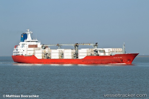
Vessel Hood Island IMO: 9059640, MMSI: 308512000 Refrigerated Cargo Ship
UTC, 5.81337, -55.16554, course: 13, speed: 0
UTC, 5.81336, -55.16549, course: 13, speed: 0
2026-03-14 13:56:27 UTC, 5.81337, -55.16550, course: 13, speed: 0
Live Vessel Hood Island Analytics (details, animations, etc.)
Live AIS position: UTC. Near Meerzorg), updated 2026-03-14 13:56:27 UTC.Find the position of the vessel Hood Island on the map. The latter are known coordinates and path.
marine traffic ship tracker show on live map
The current position of vessel Hood Island is 5.81337 lat / -55.16550 lng. Updated: 2026-03-14 13:56:27 UTCCurrently sailing under the flag of Bahamas
Hood Island built in 1994 year
Deadweight:
14140 tDetails:
Last coordinates of the vessel:
UTC, 5.81335, -55.16554, course: 13, speed: 0UTC, 5.81337, -55.16554, course: 13, speed: 0
UTC, 5.81336, -55.16549, course: 13, speed: 0
2026-03-14 13:56:27 UTC, 5.81337, -55.16550, course: 13, speed: 0