 vesseltracker.com
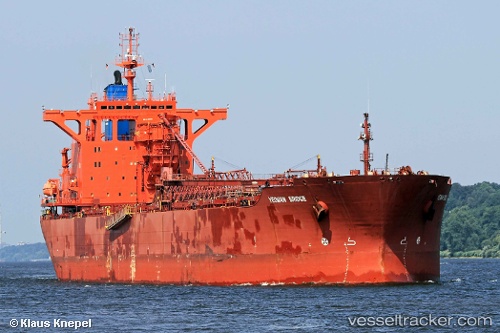
Vessel Yeoman Bridge IMO: 8912302, MMSI: 308919000 Self Discharging Bulk Carrier
UTC, 52.40986, 4.78279, course: 270, speed: 0.2
UTC, 52.40987, 4.78289, course: 270, speed: 0.1
2026-03-09 16:00:01 UTC, 52.40986, 4.78281, course: 270, speed: 0
Live Vessel Yeoman Bridge Analytics (details, animations, etc.)
Live AIS position: UTC. Near NAUERNA), updated 2026-03-09 16:00:01 UTC.Find the position of the vessel Yeoman Bridge on the map. The latter are known coordinates and path.
marine traffic ship tracker show on live map
The current position of vessel Yeoman Bridge is 52.40986 lat / 4.78281 lng. Updated: 2026-03-09 16:00:01 UTCCurrently sailing under the flag of Bahamas
Yeoman Bridge built in 1991 year
Deadweight:
96772 tDetails:
Last coordinates of the vessel:
UTC, 52.40976, 4.78287, course: 270, speed: 0.2UTC, 52.40986, 4.78279, course: 270, speed: 0.2
UTC, 52.40987, 4.78289, course: 270, speed: 0.1
2026-03-09 16:00:01 UTC, 52.40986, 4.78281, course: 270, speed: 0