 vesseltracker.com
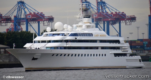
Vessel Lady Moura IMO: 1002380, MMSI: 309221000 Yacht
UTC, 18.46277, -66.10298, course: -1, speed: 0
UTC, 18.46275, -66.10297, course: -1, speed: 0
2026-03-24 07:37:43 UTC, 18.46275, -66.10295, course: -1, speed: 0
Live Vessel Lady Moura Analytics (details, animations, etc.)
Live AIS position: UTC. Near San Juan), updated 2026-03-24 07:37:43 UTC.Find the position of the vessel Lady Moura on the map. The latter are known coordinates and path.
marine traffic ship tracker show on live map
The current position of vessel Lady Moura is 18.46275 lat / -66.10295 lng. Updated: 2026-03-24 07:37:43 UTCCurrently sailing under the flag of Bahamas
Lady Moura built in 1990 year
Details:
Last coordinates of the vessel:
UTC, 18.46279, -66.10300, course: -1, speed: 0UTC, 18.46277, -66.10298, course: -1, speed: 0
UTC, 18.46275, -66.10297, course: -1, speed: 0
2026-03-24 07:37:43 UTC, 18.46275, -66.10295, course: -1, speed: 0