 vesseltracker.com
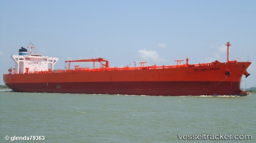
Vessel Grimstad IMO: 9336402, MMSI: 309518000 Crude Oil Tanker
UTC, 36.82265, 35.97272, course: 241, speed: 0
UTC, 36.82251, 35.97313, course: 226, speed: 0.1
2026-02-14 03:46:44 UTC, 36.82321, 35.96984, course: 150, speed: 0.2
Live AIS position:
UTC. Near Botas),
updated 2026-02-14 03:46:44 UTC.
Find the position of the vessel Grimstad on the map. The latter are known coordinates and path.
marine traffic ship tracker show on live map
The current position of vessel Grimstad is 36.82321 lat / 35.96984 lng. Updated: 2026-02-14 03:46:44 UTCCurrently sailing under the flag of Bahamas
Grimstad built in 2007 year
Deadweight:
105786 tDetails:
Last coordinates of the vessel:
UTC, 36.82345, 35.97121, course: 182, speed: 0.7UTC, 36.82265, 35.97272, course: 241, speed: 0
UTC, 36.82251, 35.97313, course: 226, speed: 0.1
2026-02-14 03:46:44 UTC, 36.82321, 35.96984, course: 150, speed: 0.2