 vesseltracker.com
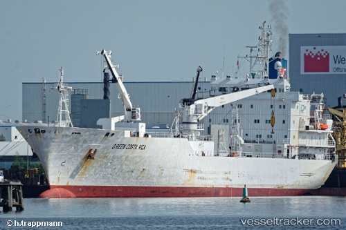
Vessel Green Costa Rica IMO: 8912120, MMSI: 309689000 Refrigerated Cargo Ship
UTC, 52.41659, 4.81181, course: 162, speed: 0
UTC, 52.41656, 4.81179, course: 162, speed: 0
2026-01-16 17:35:53 UTC, 52.41658, 4.81178, course: 162, speed: 0
Live AIS position:
UTC. Near ZAANDAM),
updated 2026-01-16 17:35:53 UTC.
Find the position of the vessel Green Costa Rica on the map. The latter are known coordinates and path.
marine traffic ship tracker show on live map
The current position of vessel Green Costa Rica is 52.41658 lat / 4.81178 lng. Updated: 2026-01-16 17:35:53 UTCCurrently sailing under the flag of Bahamas
Green Costa Rica built in 1992 year
Deadweight:
7726 tDetails:
Last coordinates of the vessel:
UTC, 52.41650, 4.81184, course: 162, speed: 0UTC, 52.41659, 4.81181, course: 162, speed: 0
UTC, 52.41656, 4.81179, course: 162, speed: 0
2026-01-16 17:35:53 UTC, 52.41658, 4.81178, course: 162, speed: 0