 vesseltracker.com
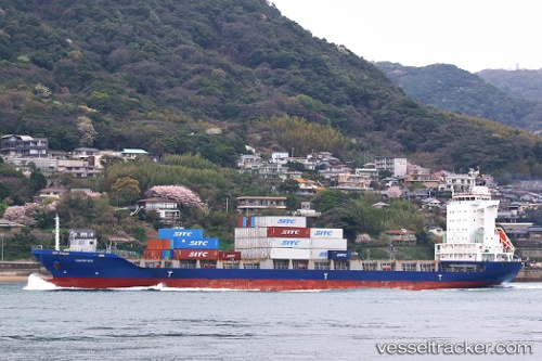
Vessel Harrier IMO: 9460057, MMSI: 309972000 Container Ship
UTC, 34.65788, 135.24101, course: 333, speed: 0
UTC, 34.65790, 135.24097, course: 333, speed: 0
2026-02-17 02:13:38 UTC, 34.65790, 135.24092, course: 333, speed: 0
Live AIS position:
UTC. Near Kobe),
updated 2026-02-17 02:13:38 UTC.
Find the position of the vessel Harrier on the map. The latter are known coordinates and path.
marine traffic ship tracker show on live map
The current position of vessel Harrier is 34.65790 lat / 135.24092 lng. Updated: 2026-02-17 02:13:38 UTCCurrently sailing under the flag of Bahamas
Details:
Last coordinates of the vessel:
UTC, 34.63493, 135.37590, course: 295, speed: 12.7UTC, 34.65788, 135.24101, course: 333, speed: 0
UTC, 34.65790, 135.24097, course: 333, speed: 0
2026-02-17 02:13:38 UTC, 34.65790, 135.24092, course: 333, speed: 0