 vesseltracker.com
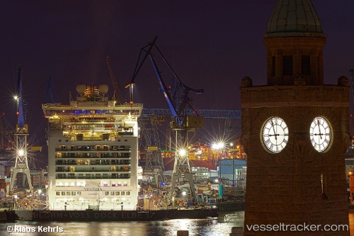
Vessel Ventura IMO: 9333175, MMSI: 310562000 Cruise Ship
UTC, 18.42248, -64.61285, course: 306, speed: 0
UTC, 18.42265, -64.61269, course: 307, speed: 0.5
2026-01-27 23:53:36 UTC, 18.38408, -64.20253, course: 78, speed: 15
Live AIS position:
UTC. 14 nm E of Spanish Town),
updated 2026-01-27 23:53:36 UTC.
Find the position of the vessel Ventura on the map. The latter are known coordinates and path.
marine traffic ship tracker show on live map
The current position of vessel Ventura is 18.38408 lat / -64.20253 lng. Updated: 2026-01-27 23:53:36 UTCCurrently sailing under the flag of Bermuda
Ventura built in 2008 year
Deadweight:
8044 tDetails:
Last coordinates of the vessel:
UTC, 18.42333, -64.61333, course: -1, speed: 0UTC, 18.42248, -64.61285, course: 306, speed: 0
UTC, 18.42265, -64.61269, course: 307, speed: 0.5
2026-01-27 23:53:36 UTC, 18.38408, -64.20253, course: 78, speed: 15