 vesseltracker.com
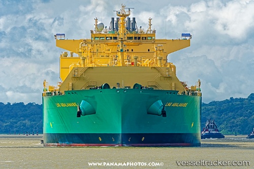
Vessel Lng Abalamabie IMO: 9690171, MMSI: 310731000 Lng Tanker
UTC, 26.01780, -16.99612, course: 197, speed: 16.5
UTC, 25.40167, -17.21833, course: -1, speed: 17
2026-02-08 09:30:52 UTC, 25.08572, -17.33337, course: 197, speed: 16.8
Live AIS position:
UTC. 103 nm NE of Las Brujas),
updated 2026-02-08 09:30:52 UTC.
Find the position of the vessel Lng Abalamabie on the map. The latter are known coordinates and path.
marine traffic ship tracker show on live map
The current position of vessel Lng Abalamabie is 25.08572 lat / -17.33337 lng. Updated: 2026-02-08 09:30:52 UTCDetails:
Last coordinates of the vessel:
UTC, 26.51667, -16.82167, course: -1, speed: 16UTC, 26.01780, -16.99612, course: 197, speed: 16.5
UTC, 25.40167, -17.21833, course: -1, speed: 17
2026-02-08 09:30:52 UTC, 25.08572, -17.33337, course: 197, speed: 16.8