 vesseltracker.com
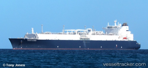
Vessel Gaslog Glasgow IMO: 9687021, MMSI: 310744000 Lng Tanker
UTC, 38.23677, 121.88520, course: 111, speed: 14.2
UTC, 38.10914, 122.69869, course: 98, speed: 15.1
2026-02-26 14:30:57 UTC, 37.92667, 123.35167, course: -1, speed: 15
Live AIS position:
UTC. 45 nm NE of Longyan Pt),
updated 2026-02-26 14:30:57 UTC.
Find the position of the vessel Gaslog Glasgow on the map. The latter are known coordinates and path.
marine traffic ship tracker show on live map
The current position of vessel Gaslog Glasgow is 37.92667 lat / 123.35167 lng. Updated: 2026-02-26 14:30:57 UTCCurrently sailing under the flag of Bermuda
Details:
Last coordinates of the vessel:
UTC, 38.37305, 121.31625, course: 120, speed: 14.6UTC, 38.23677, 121.88520, course: 111, speed: 14.2
UTC, 38.10914, 122.69869, course: 98, speed: 15.1
2026-02-26 14:30:57 UTC, 37.92667, 123.35167, course: -1, speed: 15