 vesseltracker.com
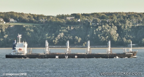
Find the position of the vessel African Harrier on the map. The latter are known coordinates and path.
marine traffic ship tracker show on live map
The current position of vessel African Harrier is -12.0479 lat / -77.1457 lng. Updated: 2025-02-22 11:26:02 UTCPort of registry:
Nassau (capital city of the Commonwealth of the Bahamas)Payload_mass:
37707 tonneGross tonnage:
23322Service entry:
2014-01-01T00:00:00ZManufacturer:
Imabari Shipbuilding (Japanese shipbuilder)
Details:
Last coordinates of the vessel:
UTC, -12.0479, -77.1457, course: 93, speed: 0UTC, -12.0479, -77.1456, course: 93, speed: 0
UTC, -12.0479, -77.1456, course: 93, speed: 0
2025-02-22 11:26:02 UTC, -12.0479, -77.1457, course: 93, speed: 0