 vesseltracker.com
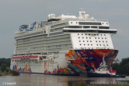
Vessel World Dream IMO: 9733117, MMSI: 311000318 Cruise Ship
UTC, -82.20078, 138.50188, course: 10, speed: 73.1
UTC, 1.28065, 103.50822, course: 64, speed: 74.5
UTC, 1.28065, 103.50822, course: 64, speed: 74.5
2026-02-03 04:11:41 UTC, 1.28065, 103.50822, course: 64, speed: 74.5
Live AIS position:
UTC. Near TANJUNG PELEPAS),
updated 2026-02-03 04:11:41 UTC.
Find the position of the vessel World Dream on the map. The latter are known coordinates and path.
marine traffic ship tracker show on live map
The current position of vessel World Dream is 1.28065 lat / 103.50822 lng. Updated: 2026-02-03 04:11:41 UTCCurrently sailing under the flag of Bahamas
Details:
Last coordinates of the vessel:
UTC, -82.20078, 138.50188, course: 10, speed: 73.1UTC, -82.20078, 138.50188, course: 10, speed: 73.1
UTC, 1.28065, 103.50822, course: 64, speed: 74.5
UTC, 1.28065, 103.50822, course: 64, speed: 74.5
2026-02-03 04:11:41 UTC, 1.28065, 103.50822, course: 64, speed: 74.5