 vesseltracker.com
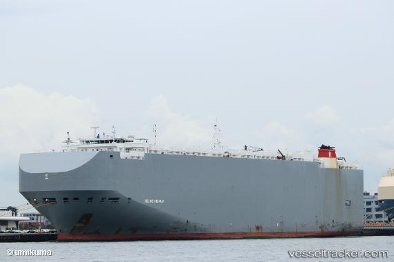
Vessel Helios Highway IMO: 9690547, MMSI: 311000321 Vehicles Carrier
UTC, 17.89426, -102.17169, course: 259, speed: 0.2
UTC, 17.89456, -102.17141, course: 265, speed: 0.1
2026-02-03 01:21:09 UTC, 17.89397, -102.17175, course: 281, speed: 0.2
Live AIS position:
UTC. Near Lazaro Cardenas),
updated 2026-02-03 01:21:09 UTC.
Find the position of the vessel Helios Highway on the map. The latter are known coordinates and path.
marine traffic ship tracker show on live map
The current position of vessel Helios Highway is 17.89397 lat / -102.17175 lng. Updated: 2026-02-03 01:21:09 UTCDetails:
Last coordinates of the vessel:
UTC, 17.89454, -102.17217, course: 251, speed: 0.1UTC, 17.89426, -102.17169, course: 259, speed: 0.2
UTC, 17.89456, -102.17141, course: 265, speed: 0.1
2026-02-03 01:21:09 UTC, 17.89397, -102.17175, course: 281, speed: 0.2