 vesseltracker.com
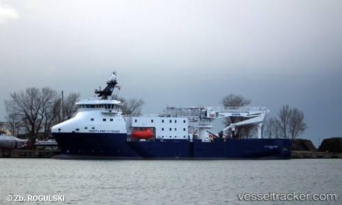
Vessel Vestland Cygnus IMO: 9714214, MMSI: 311000386 Offshore Tug Supply Ship
UTC, 53.90976, 6.59398, course: 80, speed: 5
UTC, 53.92368, 6.65022, course: 179, speed: 0.4
2026-01-15 05:53:19 UTC, 53.97492, 6.56137, course: 353, speed: 0.7
Live AIS position:
UTC. 17 nm NE of Town Quays/Drogheda),
updated 2026-01-15 05:53:19 UTC.
Find the position of the vessel Vestland Cygnus on the map. The latter are known coordinates and path.
marine traffic ship tracker show on live map
The current position of vessel Vestland Cygnus is 53.97492 lat / 6.56137 lng. Updated: 2026-01-15 05:53:19 UTCCurrently sailing under the flag of Bahamas
Details:
Last coordinates of the vessel:
UTC, 53.79667, 6.35333, course: -1, speed: 5UTC, 53.90976, 6.59398, course: 80, speed: 5
UTC, 53.92368, 6.65022, course: 179, speed: 0.4
2026-01-15 05:53:19 UTC, 53.97492, 6.56137, course: 353, speed: 0.7