 vesseltracker.com
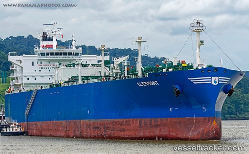
Find the position of the vessel Clermont on the map. The latter are known coordinates and path.
marine traffic ship tracker show on live map
The current position of vessel Clermont is 40.3289 lat / -139.757 lng. Updated: 2024-05-03 02:46:29 UTCPort of registry:
Nassau (capital city of the Commonwealth of the Bahamas)Payload_mass:
54543 tonneGross tonnage:
47379Service entry:
2015-01-01T00:00:00ZLocation of creation:
Samho-eup (eup of South Korea)Manufacturer:
Hyundai Samho Heavy Industries (company)Details:
Last coordinates of the vessel:
UTC, 40.5589, -140.35, course: 116, speed: 16.5UTC, 40.4917, -140.182, course: -1, speed: 16
UTC, 40.3753, -139.872, course: 118, speed: 16.5
2024-05-03 02:46:29 UTC, 40.3289, -139.757, course: 116, speed: 16.5