 vesseltracker.com
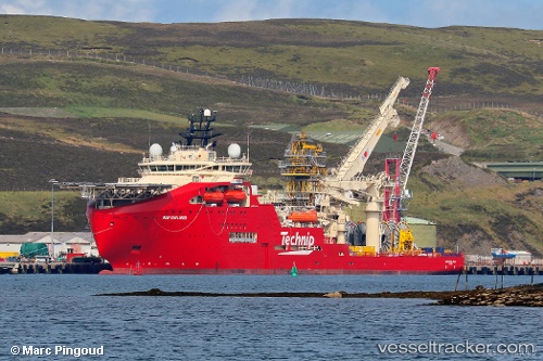
Vessel Deep Explorer IMO: 9729726, MMSI: 311000411 Offshore Support Vessel
UTC, 57.05167, 9.95167, course: -1, speed: 0
UTC, 57.05167, 9.95167, course: -1, speed: 0
2026-03-04 03:08:52 UTC, 57.05167, 9.95167, course: -1, speed: 0
Live AIS position:
UTC. Near Aalborg),
updated 2026-03-04 03:08:52 UTC.
Find the position of the vessel Deep Explorer on the map. The latter are known coordinates and path.
marine traffic ship tracker show on live map
The current position of vessel Deep Explorer is 57.05167 lat / 9.95167 lng. Updated: 2026-03-04 03:08:52 UTCCurrently sailing under the flag of Bahamas
Details:
Last coordinates of the vessel:
UTC, 57.05167, 9.95167, course: -1, speed: 0UTC, 57.05167, 9.95167, course: -1, speed: 0
UTC, 57.05167, 9.95167, course: -1, speed: 0
2026-03-04 03:08:52 UTC, 57.05167, 9.95167, course: -1, speed: 0