 vesseltracker.com
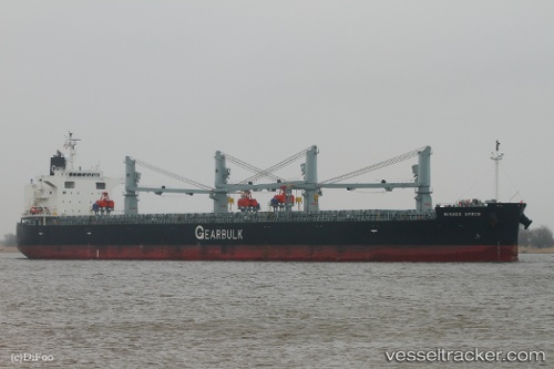
Vessel Misago Arrow IMO: 9448243, MMSI: 311000413 Bulk Carrier
UTC, 31.09465, 122.40265, course: 139, speed: 6.2
UTC, 31.09333, 122.45667, course: -1, speed: 7
2026-02-24 17:26:39 UTC, 31.09351, 122.78315, course: 93, speed: 10.3
Live AIS position:
UTC. 19 nm NE of Lü-hua Shan),
updated 2026-02-24 17:26:39 UTC.
Find the position of the vessel Misago Arrow on the map. The latter are known coordinates and path.
marine traffic ship tracker show on live map
The current position of vessel Misago Arrow is 31.09351 lat / 122.78315 lng. Updated: 2026-02-24 17:26:39 UTCDetails:
Last coordinates of the vessel:
UTC, 31.10270, 122.30881, course: 98, speed: 6.1UTC, 31.09465, 122.40265, course: 139, speed: 6.2
UTC, 31.09333, 122.45667, course: -1, speed: 7
2026-02-24 17:26:39 UTC, 31.09351, 122.78315, course: 93, speed: 10.3