 vesseltracker.com
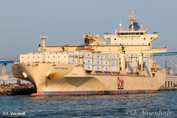
Vessel Dole Pacific IMO: 9703057, MMSI: 311000414 Container Ship
UTC, 15.44047, -95.54530, course: 77, speed: 14.4
UTC, 15.41577, -95.06423, course: 78, speed: 16.1
2026-02-01 14:14:19 UTC, 15.19360, -94.52247, course: 119, speed: 17.2
Live AIS position:
UTC. 68 nm S of Chahuites),
updated 2026-02-01 14:14:19 UTC.
Find the position of the vessel Dole Pacific on the map. The latter are known coordinates and path.
marine traffic ship tracker show on live map
The current position of vessel Dole Pacific is 15.19360 lat / -94.52247 lng. Updated: 2026-02-01 14:14:19 UTCCurrently sailing under the flag of Bahamas
Details:
Last coordinates of the vessel:
UTC, 15.34954, -96.13876, course: 78, speed: 16UTC, 15.44047, -95.54530, course: 77, speed: 14.4
UTC, 15.41577, -95.06423, course: 78, speed: 16.1
2026-02-01 14:14:19 UTC, 15.19360, -94.52247, course: 119, speed: 17.2