 vesseltracker.com
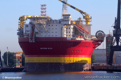
Vessel Western Isles IMO: 9736171, MMSI: 311000563 Fpso Tanker
UTC, 58.90398, -3.12792, course: 19, speed: 0.1
UTC, 58.90398, -3.12792, course: 19, speed: 0
2026-01-31 11:49:07 UTC, 58.90398, -3.12790, course: 19, speed: 0
Live AIS position:
UTC. Near Scapa Flow),
updated 2026-01-31 11:49:07 UTC.
Find the position of the vessel Western Isles on the map. The latter are known coordinates and path.
marine traffic ship tracker show on live map
The current position of vessel Western Isles is 58.90398 lat / -3.12790 lng. Updated: 2026-01-31 11:49:07 UTCCurrently sailing under the flag of Bahamas
Details:
Last coordinates of the vessel:
UTC, 58.90398, -3.12792, course: 18, speed: 0UTC, 58.90398, -3.12792, course: 19, speed: 0.1
UTC, 58.90398, -3.12792, course: 19, speed: 0
2026-01-31 11:49:07 UTC, 58.90398, -3.12790, course: 19, speed: 0