 vesseltracker.com
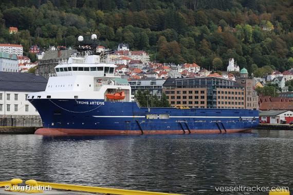
Vessel Vestland Artemis IMO: 9544516, MMSI: 311000772 Offshore Tug Supply Ship
UTC, 58.77331, -2.09495, course: 324, speed: 9.2
UTC, 59.06643, -2.09335, course: 355, speed: 11.6
2026-01-18 08:51:07 UTC, 59.13234, -2.10697, course: 356, speed: 11.7
Live AIS position:
UTC. 13 nm E of Lamb Head),
updated 2026-01-18 08:51:07 UTC.
Find the position of the vessel Vestland Artemis on the map. The latter are known coordinates and path.
marine traffic ship tracker show on live map
The current position of vessel Vestland Artemis is 59.13234 lat / -2.10697 lng. Updated: 2026-01-18 08:51:07 UTCCurrently sailing under the flag of Bahamas
Vestland Artemis built in 2011 year
Deadweight:
4900 tDetails:
Last coordinates of the vessel:
UTC, 58.64757, -2.00332, course: 353, speed: 12.5UTC, 58.77331, -2.09495, course: 324, speed: 9.2
UTC, 59.06643, -2.09335, course: 355, speed: 11.6
2026-01-18 08:51:07 UTC, 59.13234, -2.10697, course: 356, speed: 11.7