 vesseltracker.com
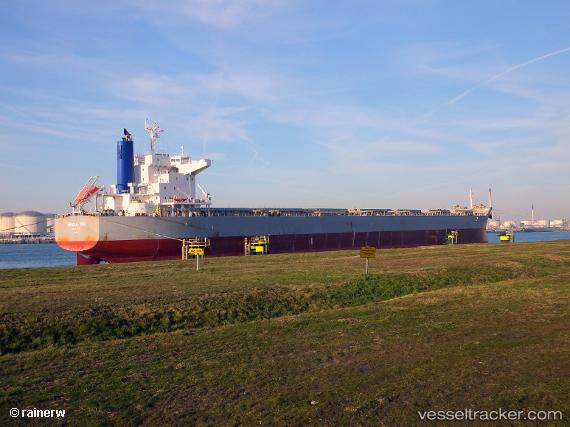
Vessel ATHINA ZAFIRAKIS IMO: 9801201, MMSI: 311001042 Bulk Carrier
UTC, 3.21039, 80.89260, course: 202, speed: 12.2
UTC, 2.27642, 80.51202, course: 200, speed: 12.2
2026-03-24 15:17:19 UTC, 1.78998, 80.32374, course: 201, speed: 11.9
Live Vessel ATHINA ZAFIRAKIS Analytics (details, animations, etc.)
Live AIS position: UTC. 249 nm S of Matara), updated 2026-03-24 15:17:19 UTC.Find the position of the vessel ATHINA ZAFIRAKIS on the map. The latter are known coordinates and path.
marine traffic ship tracker show on live map
The current position of vessel ATHINA ZAFIRAKIS is 1.78998 lat / 80.32374 lng. Updated: 2026-03-24 15:17:19 UTCCurrently sailing under the flag of Bahamas
ATHINA ZAFIRAKIS built in 2017 year
Deadweight:
81630 tDetails:
Last coordinates of the vessel:
UTC, 3.21039, 80.89260, course: 202, speed: 12.2UTC, 3.21039, 80.89260, course: 202, speed: 12.2
UTC, 2.27642, 80.51202, course: 200, speed: 12.2
2026-03-24 15:17:19 UTC, 1.78998, 80.32374, course: 201, speed: 11.9