 vesseltracker.com
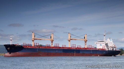
Vessel LADY LITEL IMO: 9571428, MMSI: 311001172 Bulk Carrier
UTC, -39.60833, 0.13954, course: 0, speed: 73.4
UTC, 1.28588, 103.76833, course: 297, speed: 0
UTC, 1.28588, 103.76833, course: 297, speed: 0
2026-02-04 03:08:37 UTC, 1.28588, 103.76833, course: 297, speed: 0
Live AIS position:
UTC. Near PASIR PANJANG Terminal),
updated 2026-02-04 03:08:37 UTC.
Find the position of the vessel LADY LITEL on the map. The latter are known coordinates and path.
marine traffic ship tracker show on live map
The current position of vessel LADY LITEL is 1.28588 lat / 103.76833 lng. Updated: 2026-02-04 03:08:37 UTCCurrently sailing under the flag of Bahamas
LADY LITEL built in 2013 year
Deadweight:
0 tDetails:
Last coordinates of the vessel:
UTC, -39.60833, 0.13954, course: 0, speed: 73.4UTC, -39.60833, 0.13954, course: 0, speed: 73.4
UTC, 1.28588, 103.76833, course: 297, speed: 0
UTC, 1.28588, 103.76833, course: 297, speed: 0
2026-02-04 03:08:37 UTC, 1.28588, 103.76833, course: 297, speed: 0