 vesseltracker.com
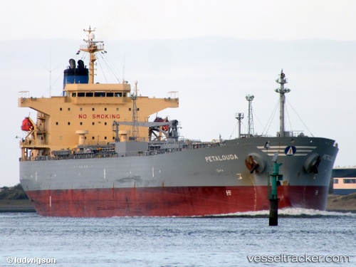
Vessel Petalouda IMO: 9367669, MMSI: 311001200 Oil Products Tanker
UTC, 25.13995, 56.48773, course: 34, speed: 0
UTC, 25.14058, 56.48725, course: 66, speed: 0
2026-02-19 07:56:59 UTC, 25.14077, 56.48708, course: 70, speed: 0
Live AIS position:
UTC. Near Fujairah),
updated 2026-02-19 07:56:59 UTC.
Find the position of the vessel Petalouda on the map. The latter are known coordinates and path.
marine traffic ship tracker show on live map
The current position of vessel Petalouda is 25.14077 lat / 56.48708 lng. Updated: 2026-02-19 07:56:59 UTCCurrently sailing under the flag of Bahamas
Petalouda built in 2008 year
Deadweight:
47322 tDetails:
Last coordinates of the vessel:
UTC, 25.13970, 56.48848, course: 355, speed: 0.1UTC, 25.13995, 56.48773, course: 34, speed: 0
UTC, 25.14058, 56.48725, course: 66, speed: 0
2026-02-19 07:56:59 UTC, 25.14077, 56.48708, course: 70, speed: 0