 vesseltracker.com
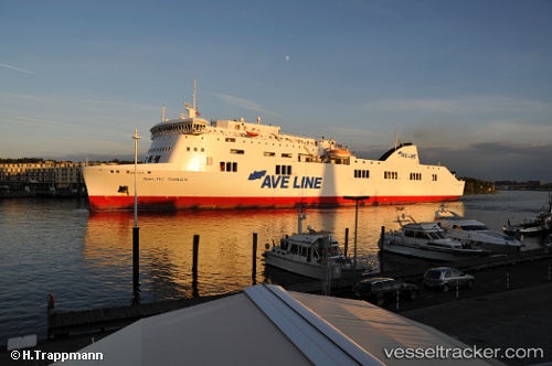
Vessel CONNEMARA IMO: 9349760, MMSI: 311001225 Ro-Ro/Passenger Ship
UTC, -41.33194, 174.52982, course: 123, speed: 20.2
UTC, -41.28083, 174.78365, course: 171, speed: 0
2026-03-01 05:37:54 UTC, -41.28082, 174.78365, course: 170, speed: 0
Live AIS position:
UTC. Near Wellington),
updated 2026-03-01 05:37:54 UTC.
Find the position of the vessel CONNEMARA on the map. The latter are known coordinates and path.
marine traffic ship tracker show on live map
The current position of vessel CONNEMARA is -41.28082 lat / 174.78365 lng. Updated: 2026-03-01 05:37:54 UTCCurrently sailing under the flag of Bahamas
Details:
Last coordinates of the vessel:
UTC, -41.28280, 174.00633, course: 43, speed: 0UTC, -41.33194, 174.52982, course: 123, speed: 20.2
UTC, -41.28083, 174.78365, course: 171, speed: 0
2026-03-01 05:37:54 UTC, -41.28082, 174.78365, course: 170, speed: 0