 vesseltracker.com
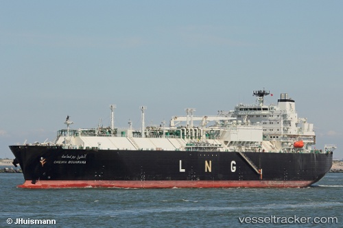
Vessel Cheikh Bouamama IMO: 9324344, MMSI: 311006300 Lng Tanker
UTC, 36.88706, 6.95514, course: 311, speed: 0
UTC, 36.88708, 6.95512, course: 311, speed: 0
2026-03-10 20:11:12 UTC, 36.88707, 6.95513, course: 311, speed: 0
Live Vessel Cheikh Bouamama Analytics (details, animations, etc.)
Live AIS position: UTC. Near Skikda), updated 2026-03-10 20:11:12 UTC.Find the position of the vessel Cheikh Bouamama on the map. The latter are known coordinates and path.
marine traffic ship tracker show on live map
The current position of vessel Cheikh Bouamama is 36.88707 lat / 6.95513 lng. Updated: 2026-03-10 20:11:12 UTCCurrently sailing under the flag of Bahamas
Cheikh Bouamama built in 2008 year
Deadweight:
39520 tDetails:
Last coordinates of the vessel:
UTC, 36.88708, 6.95518, course: 311, speed: 0UTC, 36.88706, 6.95514, course: 311, speed: 0
UTC, 36.88708, 6.95512, course: 311, speed: 0
2026-03-10 20:11:12 UTC, 36.88707, 6.95513, course: 311, speed: 0