 vesseltracker.com
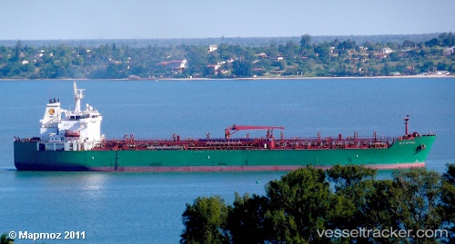
Vessel Gulf Muttrah IMO: 9381835, MMSI: 311015200 Chemical Oil Products Tanker
UTC, 51.43268, 0.67520, course: 95, speed: 0.2
UTC, 51.43257, 0.67523, course: 95, speed: 0.1
2026-02-06 19:56:06 UTC, 51.43260, 0.67522, course: 95, speed: 0.2
Live AIS position:
UTC. Near THAMESPORT),
updated 2026-02-06 19:56:06 UTC.
Find the position of the vessel Gulf Muttrah on the map. The latter are known coordinates and path.
marine traffic ship tracker show on live map
The current position of vessel Gulf Muttrah is 51.43260 lat / 0.67522 lng. Updated: 2026-02-06 19:56:06 UTCCurrently sailing under the flag of Bahamas
Details:
Last coordinates of the vessel:
UTC, 51.43260, 0.67510, course: 95, speed: 0.1UTC, 51.43268, 0.67520, course: 95, speed: 0.2
UTC, 51.43257, 0.67523, course: 95, speed: 0.1
2026-02-06 19:56:06 UTC, 51.43260, 0.67522, course: 95, speed: 0.2