 vesseltracker.com
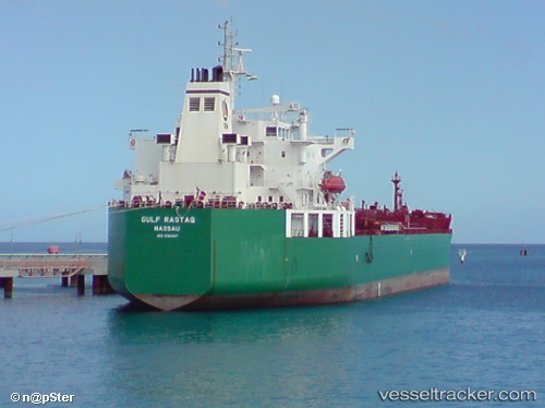
Vessel Gulf Rastaq IMO: 9381847, MMSI: 311017100 Chemical Oil Products Tanker
UTC, 49.29115, -122.89853, course: 344, speed: 1.4
UTC, 49.29857, -122.94362, course: 333, speed: 0
2026-01-15 18:22:17 UTC, 49.29830, -122.94368, course: 333, speed: 0
Live AIS position:
UTC. Near Burnaby),
updated 2026-01-15 18:22:17 UTC.
Find the position of the vessel Gulf Rastaq on the map. The latter are known coordinates and path.
marine traffic ship tracker show on live map
The current position of vessel Gulf Rastaq is 49.29830 lat / -122.94368 lng. Updated: 2026-01-15 18:22:17 UTCCurrently sailing under the flag of Bahamas
Gulf Rastaq built in 2009 year
Deadweight:
46554 tDetails:
Last coordinates of the vessel:
UTC, 49.29027, -122.89862, course: 49, speed: 0UTC, 49.29115, -122.89853, course: 344, speed: 1.4
UTC, 49.29857, -122.94362, course: 333, speed: 0
2026-01-15 18:22:17 UTC, 49.29830, -122.94368, course: 333, speed: 0