 vesseltracker.com
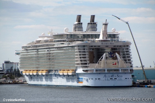
Vessel ALLURE OF THE SEAS IMO: 9383948, MMSI: 311020700 Cruise Ship
UTC, 26.12335, -79.71842, course: 248, speed: 10.7
UTC, 26.08680, -80.11973, course: 179, speed: 0
2026-02-08 12:05:32 UTC, 26.08680, -80.11973, course: 179, speed: 0
Live AIS position:
UTC. Near Port Everglades),
updated 2026-02-08 12:05:32 UTC.
Find the position of the vessel ALLURE OF THE SEAS on the map. The latter are known coordinates and path.
marine traffic ship tracker show on live map
The current position of vessel ALLURE OF THE SEAS is 26.08680 lat / -80.11973 lng. Updated: 2026-02-08 12:05:32 UTCCurrently sailing under the flag of Bahamas
ALLURE OF THE SEAS built in 2010 year
Deadweight:
19750 tDetails:
Last coordinates of the vessel:
UTC, 26.15667, -79.51667, course: -1, speed: 10UTC, 26.12335, -79.71842, course: 248, speed: 10.7
UTC, 26.08680, -80.11973, course: 179, speed: 0
2026-02-08 12:05:32 UTC, 26.08680, -80.11973, course: 179, speed: 0