 vesseltracker.com
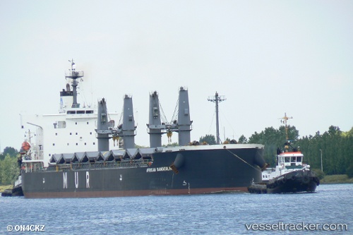
Vessel African Sanderling IMO: 9403059, MMSI: 311032100 Bulk Carrier
UTC, 34.49375, 133.68442, course: 2, speed: 0
UTC, 34.49370, 133.68445, course: 2, speed: 0
2026-01-24 03:57:06 UTC, 34.49383, 133.68446, course: 2, speed: 0
Live AIS position:
UTC. Near MIZUSHIMA),
updated 2026-01-24 03:57:06 UTC.
Find the position of the vessel African Sanderling on the map. The latter are known coordinates and path.
marine traffic ship tracker show on live map
The current position of vessel African Sanderling is 34.49383 lat / 133.68446 lng. Updated: 2026-01-24 03:57:06 UTCCurrently sailing under the flag of Bahamas
African Sanderling built in 2008 year
Deadweight:
58798 tDetails:
Last coordinates of the vessel:
UTC, 34.49365, 133.68448, course: 2, speed: 0UTC, 34.49375, 133.68442, course: 2, speed: 0
UTC, 34.49370, 133.68445, course: 2, speed: 0
2026-01-24 03:57:06 UTC, 34.49383, 133.68446, course: 2, speed: 0