 vesseltracker.com
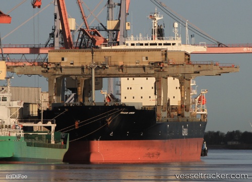
Vessel Aracari Arrow IMO: 9008706, MMSI: 311044300 Multi Purpose Carrier
UTC, 51.49333, -2.72167, course: -1, speed: 0
UTC, 51.49334, -2.72138, course: 157, speed: 0
2026-03-01 03:32:31 UTC, 51.49334, -2.72138, course: 157, speed: 0
Live AIS position:
UTC. Near PORTBURY),
updated 2026-03-01 03:32:31 UTC.
Find the position of the vessel Aracari Arrow on the map. The latter are known coordinates and path.
marine traffic ship tracker show on live map
The current position of vessel Aracari Arrow is 51.49334 lat / -2.72138 lng. Updated: 2026-03-01 03:32:31 UTCCurrently sailing under the flag of Bahamas
Aracari Arrow built in 1992 year
Deadweight:
46956 tDetails:
Last coordinates of the vessel:
UTC, 51.49335, -2.72135, course: 157, speed: 0UTC, 51.49333, -2.72167, course: -1, speed: 0
UTC, 51.49334, -2.72138, course: 157, speed: 0
2026-03-01 03:32:31 UTC, 51.49334, -2.72138, course: 157, speed: 0