 vesseltracker.com
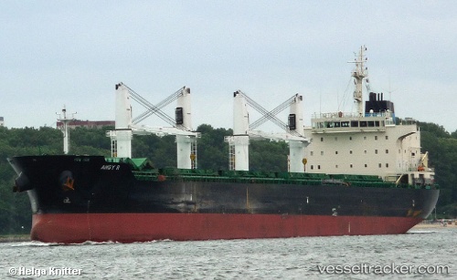
Vessel Angy R IMO: 9530955, MMSI: 311053100 Bulk Carrier
UTC, 49.41137, 1.01392, course: 196, speed: 0
UTC, 49.41134, 1.01387, course: 196, speed: 0
2026-02-09 22:18:53 UTC, 49.41135, 1.01392, course: 196, speed: 0
Live AIS position:
UTC. Near Le Grand-Quevilly),
updated 2026-02-09 22:18:53 UTC.
Find the position of the vessel Angy R on the map. The latter are known coordinates and path.
marine traffic ship tracker show on live map
The current position of vessel Angy R is 49.41135 lat / 1.01392 lng. Updated: 2026-02-09 22:18:53 UTCDetails:
Last coordinates of the vessel:
UTC, 49.41137, 1.01394, course: 196, speed: 0UTC, 49.41137, 1.01392, course: 196, speed: 0
UTC, 49.41134, 1.01387, course: 196, speed: 0
2026-02-09 22:18:53 UTC, 49.41135, 1.01392, course: 196, speed: 0