 vesseltracker.com
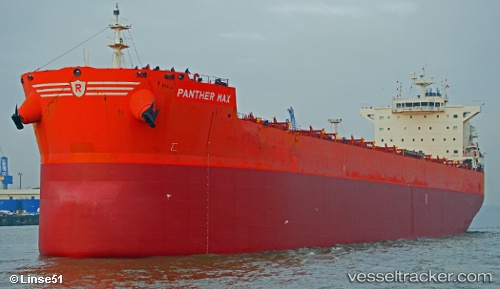
Vessel Panther Max IMO: 9593402, MMSI: 311053400 Bulk Carrier
UTC, 10.34333, -75.50667, course: -1, speed: 0
UTC, 10.34333, -75.50667, course: -1, speed: 0
2026-01-14 04:18:28 UTC, 10.34458, -75.50796, course: 118, speed: 0
Live AIS position:
UTC. Near Mamonal),
updated 2026-01-14 04:18:28 UTC.
Find the position of the vessel Panther Max on the map. The latter are known coordinates and path.
marine traffic ship tracker show on live map
The current position of vessel Panther Max is 10.34458 lat / -75.50796 lng. Updated: 2026-01-14 04:18:28 UTCCurrently sailing under the flag of Bahamas
Panther Max built in 2012 year
Deadweight:
81283 tDetails:
Last coordinates of the vessel:
UTC, 10.34459, -75.50794, course: 118, speed: 0UTC, 10.34333, -75.50667, course: -1, speed: 0
UTC, 10.34333, -75.50667, course: -1, speed: 0
2026-01-14 04:18:28 UTC, 10.34458, -75.50796, course: 118, speed: 0