 vesseltracker.com
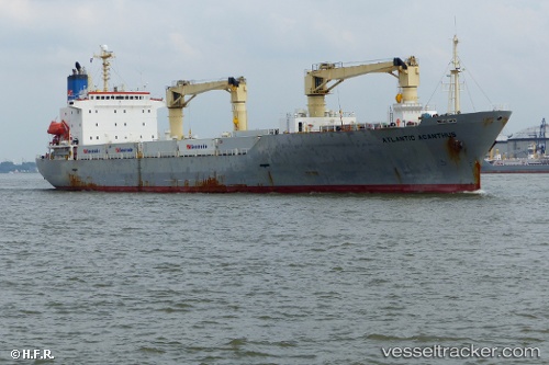
Vessel Atlantic Acanthus IMO: 9189897, MMSI: 311054900 Refrigerated Cargo Ship
UTC, 54.40787, 18.65838, course: 40, speed: 0
UTC, 54.40788, 18.65834, course: 40, speed: 0
2026-02-06 01:42:32 UTC, 54.40790, 18.65836, course: 40, speed: 0
Live AIS position:
UTC. Near Nowy Port/Gdansk),
updated 2026-02-06 01:42:32 UTC.
Find the position of the vessel Atlantic Acanthus on the map. The latter are known coordinates and path.
marine traffic ship tracker show on live map
The current position of vessel Atlantic Acanthus is 54.40790 lat / 18.65836 lng. Updated: 2026-02-06 01:42:32 UTCDetails:
Last coordinates of the vessel:
UTC, 54.40789, 18.65834, course: 40, speed: 0UTC, 54.40787, 18.65838, course: 40, speed: 0
UTC, 54.40788, 18.65834, course: 40, speed: 0
2026-02-06 01:42:32 UTC, 54.40790, 18.65836, course: 40, speed: 0