 vesseltracker.com
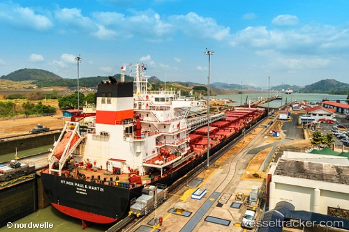
Vessel Rt Hon Paul E Martin IMO: 9600970, MMSI: 311057300 Self Discharging Bulk Carrier
UTC, 39.26027, -76.55397, course: 189, speed: 0
UTC, 39.26026, -76.55397, course: 190, speed: 0
2026-02-07 06:18:41 UTC, 39.26028, -76.55397, course: 189, speed: 0
Live AIS position:
UTC. Near Baltimore),
updated 2026-02-07 06:18:41 UTC.
Find the position of the vessel Rt Hon Paul E Martin on the map. The latter are known coordinates and path.
marine traffic ship tracker show on live map
The current position of vessel Rt Hon Paul E Martin is 39.26028 lat / -76.55397 lng. Updated: 2026-02-07 06:18:41 UTCCurrently sailing under the flag of Bahamas
Rt Hon Paul E Martin built in 2012 year
Deadweight:
71406 tDetails:
Last coordinates of the vessel:
UTC, 39.26026, -76.55397, course: 189, speed: 0UTC, 39.26027, -76.55397, course: 189, speed: 0
UTC, 39.26026, -76.55397, course: 190, speed: 0
2026-02-07 06:18:41 UTC, 39.26028, -76.55397, course: 189, speed: 0