 vesseltracker.com
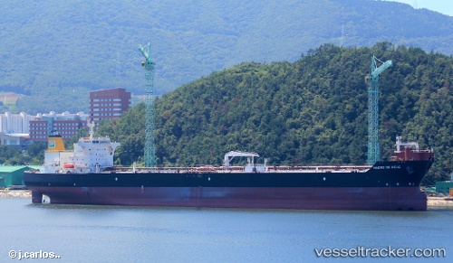
Vessel Madre De Deus IMO: 9492050, MMSI: 311065400 Crude Oil Tanker
UTC, -23.06156, -44.22922, course: 101, speed: 0
UTC, -23.06157, -44.22928, course: 101, speed: 0
2026-01-25 12:15:31 UTC, -23.06151, -44.22931, course: 101, speed: 0
Live AIS position:
UTC. Near TEBIG),
updated 2026-01-25 12:15:31 UTC.
Find the position of the vessel Madre De Deus on the map. The latter are known coordinates and path.
marine traffic ship tracker show on live map
The current position of vessel Madre De Deus is -23.06151 lat / -44.22931 lng. Updated: 2026-01-25 12:15:31 UTCDetails:
Last coordinates of the vessel:
UTC, -23.06156, -44.22925, course: 101, speed: 0UTC, -23.06156, -44.22922, course: 101, speed: 0
UTC, -23.06157, -44.22928, course: 101, speed: 0
2026-01-25 12:15:31 UTC, -23.06151, -44.22931, course: 101, speed: 0