 vesseltracker.com
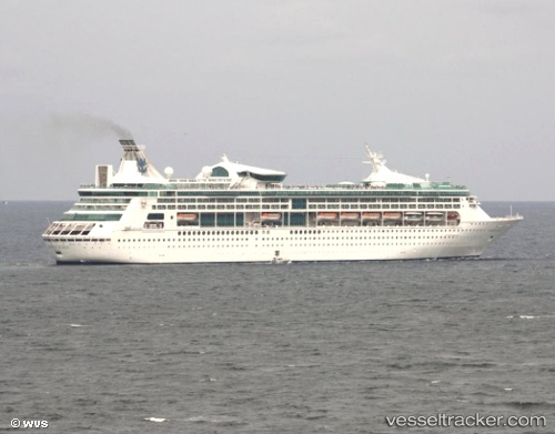
Vessel Grandeur Of The Seas IMO: 9102978, MMSI: 311315000 Cruise Ship
UTC, 26.84833, -83.50667, course: -1, speed: 14
UTC, 27.24500, -83.32333, course: -1, speed: 13
2026-03-14 06:26:19 UTC, 27.60269, -82.87247, course: 84, speed: 14.6
Live Vessel Grandeur Of The Seas Analytics (details, animations, etc.)
Live AIS position: UTC. Near Anna Maria), updated 2026-03-14 06:26:19 UTC.Find the position of the vessel Grandeur Of The Seas on the map. The latter are known coordinates and path.
marine traffic ship tracker show on live map
The current position of vessel Grandeur Of The Seas is 27.60269 lat / -82.87247 lng. Updated: 2026-03-14 06:26:19 UTCCurrently sailing under the flag of Bahamas
Grandeur Of The Seas built in 1996 year
Deadweight:
7000 tDetails:
Last coordinates of the vessel:
UTC, 26.41833, -83.74500, course: -1, speed: 14UTC, 26.84833, -83.50667, course: -1, speed: 14
UTC, 27.24500, -83.32333, course: -1, speed: 13
2026-03-14 06:26:19 UTC, 27.60269, -82.87247, course: 84, speed: 14.6