 vesseltracker.com
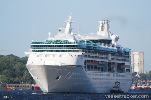
Vessel Vision Of The Seas IMO: 9116876, MMSI: 311321000 Cruise Ship
UTC, 38.32146, -76.30549, course: 161, speed: 20.7
UTC, 37.80500, -76.17500, course: -1, speed: 20
2026-01-17 01:34:20 UTC, 37.63139, -76.11140, course: 143, speed: 18.7
Live AIS position:
UTC. 13 nm E of Kilmarnock),
updated 2026-01-17 01:34:20 UTC.
Find the position of the vessel Vision Of The Seas on the map. The latter are known coordinates and path.
marine traffic ship tracker show on live map
The current position of vessel Vision Of The Seas is 37.63139 lat / -76.11140 lng. Updated: 2026-01-17 01:34:20 UTCCurrently sailing under the flag of Bahamas
Vision Of The Seas built in 1998 year
Deadweight:
5000 tDetails:
Last coordinates of the vessel:
UTC, 38.54644, -76.43059, course: 159, speed: 19.6UTC, 38.32146, -76.30549, course: 161, speed: 20.7
UTC, 37.80500, -76.17500, course: -1, speed: 20
2026-01-17 01:34:20 UTC, 37.63139, -76.11140, course: 143, speed: 18.7