 vesseltracker.com
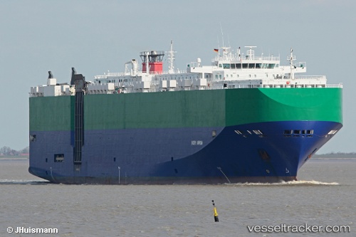
Vessel Ivory Arrow IMO: 9277838, MMSI: 311696000 Vehicles Carrier
UTC, 34.62788, 138.22865, course: 16, speed: 6.2
UTC, 34.61382, 138.44742, course: 105, speed: 8.6
2026-01-30 09:38:06 UTC, 34.49311, 138.80785, course: 112, speed: 11.2
Live AIS position:
UTC. Near Iruma),
updated 2026-01-30 09:38:06 UTC.
Find the position of the vessel Ivory Arrow on the map. The latter are known coordinates and path.
marine traffic ship tracker show on live map
The current position of vessel Ivory Arrow is 34.49311 lat / 138.80785 lng. Updated: 2026-01-30 09:38:06 UTCDetails:
Last coordinates of the vessel:
UTC, 34.61833, 138.21832, course: -1, speed: 0UTC, 34.62788, 138.22865, course: 16, speed: 6.2
UTC, 34.61382, 138.44742, course: 105, speed: 8.6
2026-01-30 09:38:06 UTC, 34.49311, 138.80785, course: 112, speed: 11.2