 vesseltracker.com
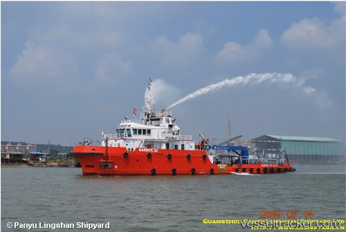
Vessel Maridive32 IMO: 9523055, MMSI: 312019000 Offshore Support Vessel
UTC, 28.57769, 48.71236, course: 47, speed: 6.8
UTC, 28.71541, 48.94156, course: 55, speed: 6.3
2026-01-29 12:04:14 UTC, 28.76328, 48.93599, course: 101, speed: 0.2
Live AIS position:
UTC. 28 nm E of Mina Saud),
updated 2026-01-29 12:04:14 UTC.
Find the position of the vessel Maridive32 on the map. The latter are known coordinates and path.
marine traffic ship tracker show on live map
The current position of vessel Maridive32 is 28.76328 lat / 48.93599 lng. Updated: 2026-01-29 12:04:14 UTCCurrently sailing under the flag of Belize
Maridive32 built in 2009 year
Deadweight:
550 tDetails:
Last coordinates of the vessel:
UTC, 28.41733, 48.52930, course: 59, speed: 6.1UTC, 28.57769, 48.71236, course: 47, speed: 6.8
UTC, 28.71541, 48.94156, course: 55, speed: 6.3
2026-01-29 12:04:14 UTC, 28.76328, 48.93599, course: 101, speed: 0.2