 vesseltracker.com
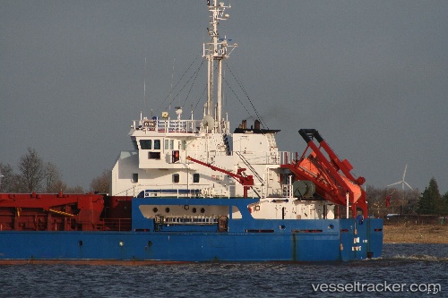
Vessel Lina IMO: 9128001, MMSI: 312481000 Multi Purpose Carrier
UTC, 42.15376, 41.66014, course: 92, speed: 0
UTC, 42.15373, 41.66011, course: 91, speed: 0
2026-02-08 03:53:25 UTC, 42.15376, 41.66015, course: 91, speed: 0
Live AIS position:
UTC. Near Poti),
updated 2026-02-08 03:53:25 UTC.
Find the position of the vessel Lina on the map. The latter are known coordinates and path.
marine traffic ship tracker show on live map
The current position of vessel Lina is 42.15376 lat / 41.66015 lng. Updated: 2026-02-08 03:53:25 UTCCurrently sailing under the flag of Belize
Lina built in 1996 year
Deadweight:
4400 tDetails:
Last coordinates of the vessel:
UTC, 42.15376, 41.66021, course: 92, speed: 0UTC, 42.15376, 41.66014, course: 92, speed: 0
UTC, 42.15373, 41.66011, course: 91, speed: 0
2026-02-08 03:53:25 UTC, 42.15376, 41.66015, course: 91, speed: 0