 vesseltracker.com
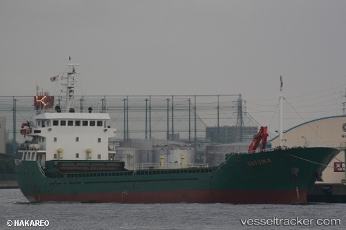
Vessel JIN DONG 7 IMO: 9330551, MMSI: 312817000 General Cargo Ship
UTC, 54.90165, -1.36032, course: -1, speed: 0
UTC, 54.90165, -1.36032, course: -1, speed: 0
2026-03-03 17:20:35 UTC, 54.90165, -1.36032, course: -1, speed: 0
Live AIS position:
UTC. Near Sunderland),
updated 2026-03-03 17:20:35 UTC.
Find the position of the vessel JIN DONG 7 on the map. The latter are known coordinates and path.
marine traffic ship tracker show on live map
The current position of vessel JIN DONG 7 is 54.90165 lat / -1.36032 lng. Updated: 2026-03-03 17:20:35 UTCCurrently sailing under the flag of Belize
JIN DONG 7 built in 2004 year
Deadweight:
4150 tDetails:
Last coordinates of the vessel:
UTC, 54.90165, -1.36028, course: -1, speed: 0UTC, 54.90165, -1.36032, course: -1, speed: 0
UTC, 54.90165, -1.36032, course: -1, speed: 0
2026-03-03 17:20:35 UTC, 54.90165, -1.36032, course: -1, speed: 0