 vesseltracker.com
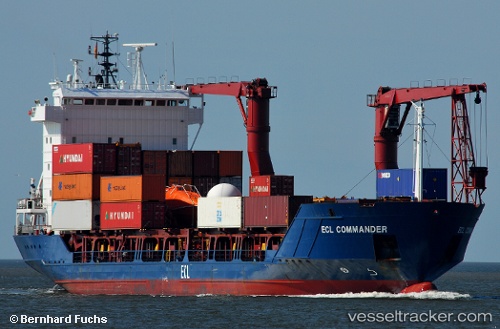
 Samskip Commander
Current Status
Where is the vessel?
Samskip Commander is currently in Near Alesund, based on AIS data received about 1h ago.
Latest AIS update:
Current position: 62.48191° N, 6.19384° E (Near Alesund)
Average speed (last 7 days): Loading…
Average speed (last 30 days): Loading…
Vessel profile: Samskip Commander is a Container Ship with dimensions 101m x 16m.
This page combines live AIS, route history, probable destination signals, nearby traffic, and port activity for practical vessel monitoring.
The current position of vessel Samskip Commander is 62.48191 lat / 6.19384 lng. Updated: 2026-03-25 14:14:19 UTCNearest reference points:
- Near Alesund
- Near Gjøsundet
- Near Fiskarstrand
Currently sailing under the flag of Barbados ![]()
Samskip Commander built in 1997 year
Deadweight:
4765 tDetails:
Live Vessel Samskip Commander Analytics (details, animations, etc.)
Recent AIS points (UTC):
2026-03-25 07:44:27 UTC · 62.21569, 5.89175 · SOG 13.1 kn · COG 37°2026-03-25 09:27:05 UTC · 62.48209, 6.19454 · SOG 1.5 kn · COG 222°
2026-03-25 11:43:21 UTC · 62.48191, 6.19384 · SOG 0 kn · COG 208°
2026-03-25 14:14:19 UTC · 62.48191, 6.19384 · SOG 0 kn · COG 208°