 vesseltracker.com
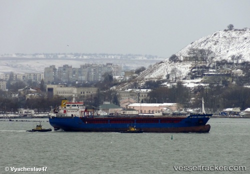
Vessel NACI SELIMOGLU IMO: 9382059, MMSI: 314506000 General Cargo Ship
UTC, 44.71070, 37.84445, course: 321, speed: 15.8
UTC, 44.71070, 37.84445, course: 321, speed: 15.8
2026-03-20 04:56:57 UTC, 44.71070, 37.84445, course: 321, speed: 15.8
Live Vessel NACI SELIMOGLU Analytics (details, animations, etc.)
Live AIS position: UTC. Near Novorossiysk), updated 2026-03-20 04:56:57 UTC.Find the position of the vessel NACI SELIMOGLU on the map. The latter are known coordinates and path.
marine traffic ship tracker show on live map
The current position of vessel NACI SELIMOGLU is 44.71070 lat / 37.84445 lng. Updated: 2026-03-20 04:56:57 UTCCurrently sailing under the flag of Barbados
NACI SELIMOGLU built in 2007 year
Deadweight:
5229 tDetails:
Last coordinates of the vessel:
UTC, 44.72593, 37.79697, course: 321, speed: 23.8UTC, 44.71070, 37.84445, course: 321, speed: 15.8
UTC, 44.71070, 37.84445, course: 321, speed: 15.8
2026-03-20 04:56:57 UTC, 44.71070, 37.84445, course: 321, speed: 15.8