 vesseltracker.com
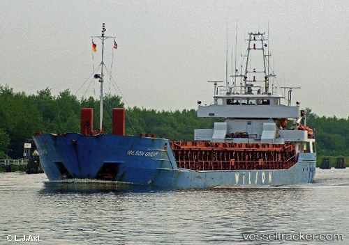
Vessel WILSON GHENT IMO: 9150236, MMSI: 314548000 General Cargo Ship
UTC, 53.34971, -2.90354, course: 214, speed: 0
UTC, 53.34972, -2.90351, course: 214, speed: 0
2026-02-24 11:43:19 UTC, 53.34972, -2.90356, course: 214, speed: 0
Live AIS position:
UTC. Near GARSTON),
updated 2026-02-24 11:43:19 UTC.
Find the position of the vessel WILSON GHENT on the map. The latter are known coordinates and path.
marine traffic ship tracker show on live map
The current position of vessel WILSON GHENT is 53.34972 lat / -2.90356 lng. Updated: 2026-02-24 11:43:19 UTCCurrently sailing under the flag of Barbados
WILSON GHENT built in 1996 year
Deadweight:
3707 tDetails:
Last coordinates of the vessel:
UTC, 53.34969, -2.90359, course: 214, speed: 0UTC, 53.34971, -2.90354, course: 214, speed: 0
UTC, 53.34972, -2.90351, course: 214, speed: 0
2026-02-24 11:43:19 UTC, 53.34972, -2.90356, course: 214, speed: 0