 vesseltracker.com
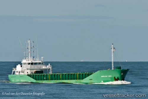
Vessel FLUVIUS AXE IMO: 9163623, MMSI: 314654000 General Cargo Ship
UTC, 51.81894, 4.70024, course: -1, speed: 0
UTC, 51.81885, 4.70028, course: 272, speed: 0
2026-03-04 19:30:54 UTC, 51.81892, 4.70027, course: 272, speed: 0
Live Vessel FLUVIUS AXE Analytics (details, animations, etc.)
Live AIS position: UTC. Near PAPENDRECHT), updated 2026-03-04 19:30:54 UTC.Find the position of the vessel FLUVIUS AXE on the map. The latter are known coordinates and path.
marine traffic ship tracker show on live map
The current position of vessel FLUVIUS AXE is 51.81892 lat / 4.70027 lng. Updated: 2026-03-04 19:30:54 UTCCurrently sailing under the flag of Barbados
FLUVIUS AXE built in 1998 year
Deadweight:
3193 tDetails:
Last coordinates of the vessel:
UTC, 51.81892, 4.70027, course: 272, speed: 0UTC, 51.81894, 4.70024, course: -1, speed: 0
UTC, 51.81885, 4.70028, course: 272, speed: 0
2026-03-04 19:30:54 UTC, 51.81892, 4.70027, course: 272, speed: 0