 vesseltracker.com
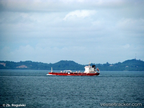
Vessel GRIFFIN T IMO: 9390537, MMSI: 314807000 Chemical Tanker
UTC, 41.33262, 2.19630, course: 43, speed: 0
UTC, 41.33263, 2.19625, course: 53, speed: 0
2026-03-08 05:30:35 UTC, 41.33259, 2.19646, course: 49, speed: 0
Live Vessel GRIFFIN T Analytics (details, animations, etc.)
Live AIS position: UTC. Near Barcelona), updated 2026-03-08 05:30:35 UTC.Find the position of the vessel GRIFFIN T on the map. The latter are known coordinates and path.
marine traffic ship tracker show on live map
The current position of vessel GRIFFIN T is 41.33259 lat / 2.19646 lng. Updated: 2026-03-08 05:30:35 UTCCurrently sailing under the flag of Barbados
Details:
Last coordinates of the vessel:
UTC, 41.33266, 2.19637, course: 60, speed: 0.3UTC, 41.33262, 2.19630, course: 43, speed: 0
UTC, 41.33263, 2.19625, course: 53, speed: 0
2026-03-08 05:30:35 UTC, 41.33259, 2.19646, course: 49, speed: 0