 vesseltracker.com
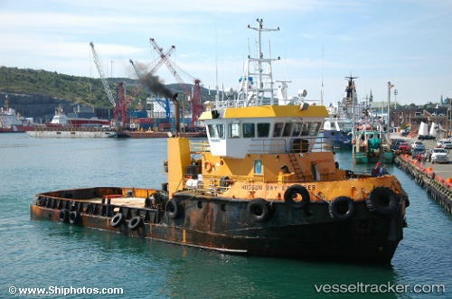
Vessel Hudson Bay Explorer IMO: 7208651, MMSI: 316003680 Offshore Tug Supply Ship
UTC, 45.06667, -66.80667, course: -1, speed: 0
UTC, 45.06667, -66.80667, course: -1, speed: 0
2026-01-16 13:23:50 UTC, 45.06791, -66.80812, course: 220, speed: 0.1
Live AIS position:
UTC. Near Saint-George),
updated 2026-01-16 13:23:50 UTC.
Find the position of the vessel Hudson Bay Explorer on the map. The latter are known coordinates and path.
marine traffic ship tracker show on live map
The current position of vessel Hudson Bay Explorer is 45.06791 lat / -66.80812 lng. Updated: 2026-01-16 13:23:50 UTCDetails:
Last coordinates of the vessel:
UTC, 45.06667, -66.80667, course: -1, speed: 0UTC, 45.06667, -66.80667, course: -1, speed: 0
UTC, 45.06667, -66.80667, course: -1, speed: 0
2026-01-16 13:23:50 UTC, 45.06791, -66.80812, course: 220, speed: 0.1