 vesseltracker.com
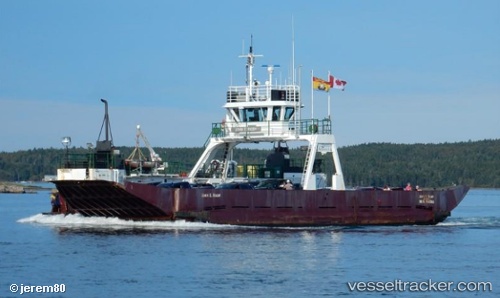
Vessel John E Rigby IMO: 7643186, MMSI: 316012053 Passenger Ship
UTC, 45.04667, -66.80667, course: -1, speed: 0
UTC, 45.04667, -66.80667, course: -1, speed: 0
2026-03-02 23:52:58 UTC, 45.04667, -66.80667, course: -1, speed: 0
Live AIS position:
UTC. Near Saint-George),
updated 2026-03-02 23:52:58 UTC.
Find the position of the vessel John E Rigby on the map. The latter are known coordinates and path.
marine traffic ship tracker show on live map
The current position of vessel John E Rigby is 45.04667 lat / -66.80667 lng. Updated: 2026-03-02 23:52:58 UTCDetails:
Last coordinates of the vessel:
UTC, 45.04667, -66.80667, course: -1, speed: 0UTC, 45.04667, -66.80667, course: -1, speed: 0
UTC, 45.04667, -66.80667, course: -1, speed: 0
2026-03-02 23:52:58 UTC, 45.04667, -66.80667, course: -1, speed: 0