 vesseltracker.com
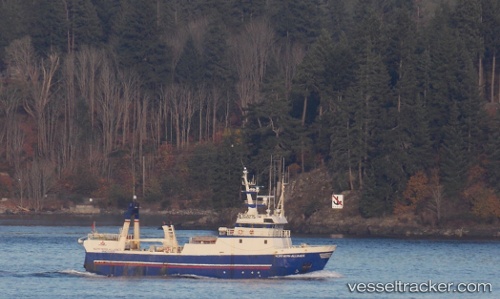
Vessel Northern Alliance IMO: 8714437, MMSI: 316022149 Fishing Vessel
UTC, 44.37625, -64.31686, course: -1, speed: 0
UTC, 44.37625, -64.31696, course: -1, speed: 0
2026-03-25 02:29:51 UTC, 44.37624, -64.31692, course: -1, speed: 0
Live Vessel Northern Alliance Analytics (details, animations, etc.)
Live AIS position: UTC. Near Riverport), updated 2026-03-25 02:29:51 UTC.Find the position of the vessel Northern Alliance on the map. The latter are known coordinates and path.
marine traffic ship tracker show on live map
The current position of vessel Northern Alliance is 44.37624 lat / -64.31692 lng. Updated: 2026-03-25 02:29:51 UTCCurrently sailing under the flag of Canada
Northern Alliance built in 1990 year
Deadweight:
229 tDetails:
Last coordinates of the vessel:
UTC, 44.37622, -64.31693, course: -1, speed: 0UTC, 44.37625, -64.31686, course: -1, speed: 0
UTC, 44.37625, -64.31696, course: -1, speed: 0
2026-03-25 02:29:51 UTC, 44.37624, -64.31692, course: -1, speed: 0