 vesseltracker.com
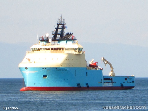
Vessel Maersk Clipper IMO: 9649926, MMSI: 316026728 Offshore Tug Supply Ship
UTC, 46.47563, -48.48178, course: 227, speed: 0.2
UTC, 46.47565, -48.48180, course: 226, speed: 0.8
2026-01-19 04:26:11 UTC, 46.47500, -48.47833, course: -1, speed: 0
Live AIS position:
UTC. 27 nm SW of White Rose Field),
updated 2026-01-19 04:26:11 UTC.
Find the position of the vessel Maersk Clipper on the map. The latter are known coordinates and path.
marine traffic ship tracker show on live map
The current position of vessel Maersk Clipper is 46.47500 lat / -48.47833 lng. Updated: 2026-01-19 04:26:11 UTCCurrently sailing under the flag of Canada
Details:
Last coordinates of the vessel:
UTC, 46.47500, -48.48167, course: -1, speed: 0UTC, 46.47563, -48.48178, course: 227, speed: 0.2
UTC, 46.47565, -48.48180, course: 226, speed: 0.8
2026-01-19 04:26:11 UTC, 46.47500, -48.47833, course: -1, speed: 0